I decided to start my examination of the distant shore at Manchester.
The big peninsula that gives Northwest Washington its odd shape, the peninsula with Mount Olympus and the famous rain forests, is the Olympic Peninsula. Protruding from it, or, perhaps more accurately, within it, is an arrowhead-shaped land mass called the Kitsap Peninsula, separated from the rest by a long narrow channel called Hood Canal. Islands flank the eastern side of the peninsula like little bits broken off from it, hiding much of it from Seattle; but a few miles are exposed to us, and this stretch of the skyline offers attractive facilities and a chance to reconnoiter some places that will be important later, like Blake Island and the southern end of Bainbridge.
One day in July I picked up the boat at Salmon Bay, put it on the car and arrived at Fauntleroy before 9:30, in time for the one of the last reverse-commute ferry sailings. Even with an intermediate stop at Vashon Island it was a quick and pleasant crossing to Southworth.
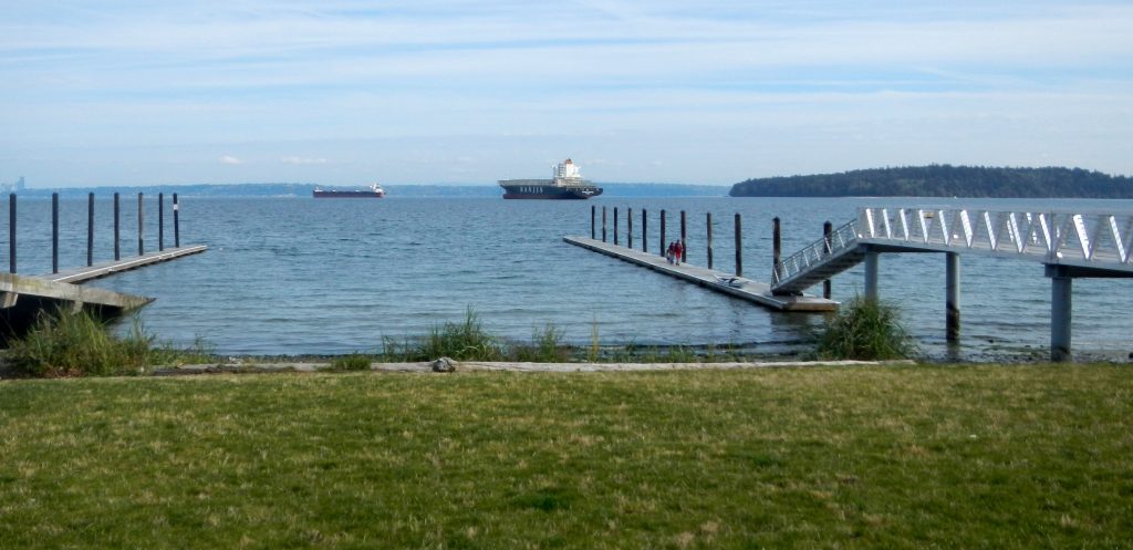
Driving north from there, following my recollection of the map I had sketched the night before, I soon arrived at Pomeroy Park. I wasn’t sure whether the Port of Manchester expects people without boat trailers to pay for parking, but I bought a ticket just in case, for $7, from a machine that takes credit cards. There are two docks, one attractive to kayakers but still high enough to require some effort getting in and out. The deck grating provides useful finger-holds. A small adjacent beach would be an alternative.
I chatted a bit with a fellow who was fishing for crabs, and then paddled off to the north. The first landmark is a big pier with signs warning that it belongs to the government and to keep away. This is Orchard Point, which appears on the charts without much explanation, perhaps not to attract the attention of evil-doers. The Navy has a lot of facilities between here and Bremerton; they also had a very big ship anchored off Manchester, but there seemed to be plenty of space for me to go between.
I paddled past Clam Bay, skirting an array of buoys there. arriving at the beach at Manchester State Park sooner than I was expecting, and paused for a snack. There was a selection of logs for seating, complete with a neighborly ground squirrel. Upland there was some kind of event organized for youngsters, but they seemed mostly occupied with food and games.
I took a good look across Rich Passage toward Fort Ward. I had chosen this day in part for its small and well-timed tidal exchange, thinking that I might try crossing to Bainbridge Island. But exploring the other park looked like a bigger project than I wanted, so I topped off my water bottle and just headed back. I had come further than necessary already: my part of Seattle was well out of view until I was back at Clam Bay. I glimpsed a marine mammal spying on me there. I think it was probably a seal, but it didn’t wait around for introductions. There were also many jellyfish along the way.
That first trip to Manchester took care of only a very small portion of the visible coast. I returned just before the end of September to paddle a few miles south toward the mouth of Curly Creek, and then followed the shoreline east just a bit to an old pier where I was sure that Seattle was well hidden behind Blake Island. Each way I kept a respectful distance from a float where a number of seals were resting and sunning themselves; but both times one of their number launched to follow me and make sure that I left their area safely. The ship is one of several, probably idled by a shipping company’s bankruptcy, anchored near Seattle.
Back at the Southworth ferry dock I took some time to examine the facilities there and especially the parking arrangements. This will be the place to launch for an eventual overnight trip to Blake Island.


